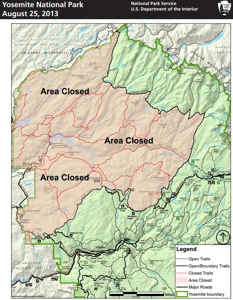
Details of the Yosemite National Park closures may be found at:
http://www.nps.gov/yose/planyourvisit/rimfire.htm
On Twitter Cal Fire sent out a tweet on current conditions this morning at 7:35 am:
#RimFire [update] near #Yosemite (Tuolumne County) is now 149,780 acres & 15% contained. http://inciweb.org/incident/3660/
Cal Fire's page for incident updates is found at:
http://inciweb.org/incident/3660/
The latest Cal Fire map color-coded to show daily progress of the fire is available at:
http://inciweb.nwcg.gov/photos/CASTF/2013-08-17-1950-Rim/picts/2013_08_26-14.11.21.961-CDT.jpeg

No comments:
Post a Comment