Showing posts with label April. Show all posts

Monday, May 02, 2016

April Road Trip to Death Valley

Natural Bridge
You may have noticed that I'm obsessed with death. Death Valley National Park, that is! I grew up in New England, just about as far from the desert as you can get in America, so in my current quest to explore the largest national park in the Lower 48 States, I must be making up for lost time. 

Mesquite Flat Dunes
Fortunately, currently living in the nearby Eastern Sierra region, I'm only 3-4 hours from a couple of park entrances, so I can indulge in my desert yearnings frequently. I usually visit once or twice in the Thanksgiving to New Year's Day time period, then again in February and March as the wildflowers start to bloom. But as spring continues and Death Valley starts to really warm up, I like looking for storms and bouts of cooler weather, in case I can slip one or two more visits in before it gets too hot. 

In April 2016 I could see a storm front approaching in the weather forecast. Daytime high temperatures would drop into the 80s.  I'm currently working on a detailed photographer's travel guide to the park to be offered in the +SNAPP Guides app, so I threw my camera and camping gear into the car, and headed to the park with a list of the sites I wanted to explore or revisit next.

I hiked to a natural bridge, and enjoyed great views with sunlight streaming through clouds. I explored stone-walled buildings at an old mining town site, and found wildflowers thriving at higher elevations than on past visits this year.

I met a Subaru coming out the wrong way from Titus Canyon, apparently deciding that "high clearance" meant higher then they had. The worst part of the road is about halfway through the 24-mile loop, so drivers that wait that long have a lot of wrong-way driving to do. Sometimes they're in a hurry to get out, so they come flying around blind turns!

On the edge of a canyon, two jets saw me with my camera, so they took two passes each direction up the canyon, turning and shooting up sharply right in front of me, so I was able to get some great shots. They were very fast, very close, and very loud!

In Salt Creek, the water was slightly higher than normal, so the pupfish were exploring down to the parking lot, feeding in the flooded margins before low water forced them back into their normal cramped habitat space. Normally they're a little skittish, but their quest for food prevailed, so when I held my iPhone out over the water, one came over and posed for a portrait.

On one evening, I caught a sandstorm over Mesquite Flat Dunes, back-lit with golden sunlight by the setting sun.

On the way home, sunset light was lighting up rain showers at Mono Lake. It was an eventful and productive trip. I can't wait to return!  In the meantime, I've uploaded the latest batch of photos to the Death Valley 2016 photo album on my +Death Valley Workshops page on Google+.

If you might like to join me in Death Valley sometime, my spring 2016 workshops are done for the season, but I can add a session in mid-December if there's sufficient interest: Death Valley Photography Workshops.

Jellyfish Cloud
Sunset rain showers over Mono Lake

Sunday, April 03, 2016

California Spring Wildflower Sites, April: Antelope Valley

The Mojave Desert in April
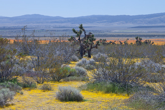
Goldfields and California poppies mix with Joshua trees in Antelope Valley near Lancaster
One of my favorite photography road trips ever was a tour of California wildflower sites in the spring, including Antelope Valley and the California State Poppy Reserve, Carrizo Plain National Monument, Figueroa Mountain Recreation Area in the +Los Padres National Forest, and the area covered by the annual Ridgecrest Wildflower Festival in the Eastern Sierra. I posted on my blog at the time some of my favorite photos from the Antelope Valley, but I have a little more time now to take a second pass and show you more of what I saw.

I'm considering taking that route again this year, so reviewing past trips and refreshing my memory on what to stop in on and check can be productive. I've also looked up the wildflower report at the California State Poppy Reserve, which posted this update on Saturday, April 2:

"The season appears to have ended early, as last month's rains came too late to sustain the bloom that had barely started. The fields are mostly grasses now; only a handful of poppies are blooming alongside the trails. The beavertail cactus in front of the visitor center is blooming, which usually happens after the season has ended- a sign that an early summer is on the way."

An early start to summer should not be entirely unexpected, given the record El Nino heat in the Pacific Ocean driving our weather pattern in recent months. It's a shame though that it didn't bring enough rain at the right time to deliver a bumper crop of wildflowers in the Antelope Valley. The Antelope Valley is large though, and there may be dispersed pockets where enough rain fell, perhaps with a northern exposure to minimize drying during the gap in winter storms in February. Much of the area is in the Mojave Desert ecosystem, where Joshua trees serve as gerat subjects, with or without wildflowers.

In any case, many other areas of Southern California desert are blooming with normal to above normal intensity, so if I decide to take the trip, the conditions in the Antelope Valley won't make or break the outcome.

So while I have my photos handy, here are a few more photos from the Antelope Valley area on that prior trip, and I'll sprinkle a few across my various social media accounts as well.


The Antelope Valley California Poppy Reserve often starts its wildflower reports in mid-March to keep visitors updated on the conditions as they peak at some point through April. The area celebrates the annual bloom at the California Poppy Festival.  This year the 25th California Poppy Festival will be held April 16-17, 2016.

For more information, I cover the Antelope Valley California State Poppy Reserve, and other sites to visit on an April California wildflower tour, on page 184 of my new 320-page guidebook, "Photographing California Vol. 2 - South (shown to the right).

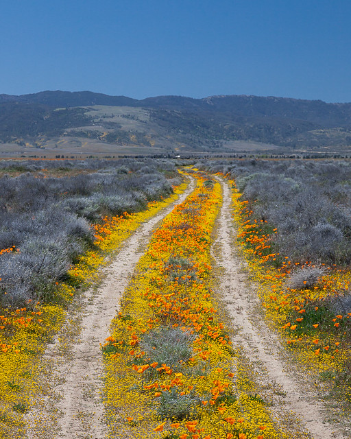
Road to Nowhere

Friday, April 01, 2016

California Wildflowers in April: Figueroa Mountain Road

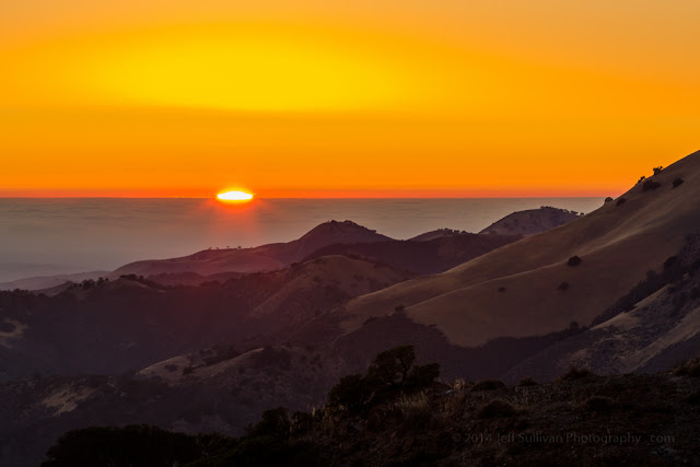
Sunset from Figueroa Mountain Road
Are you looking for a place to find wildflowers along California's Central Coast? Figueroa Mountain can be a great place to see wildflowers when the timing is right. Helen Tarbet of the Los Padres National Forest sent out her first wildflower update of 2016 to email subscribers on March 18. She reports that "California poppies are blooming throughout the mountain" and "Other wildflowers to look for as you continue your uphill climb include, buttercups, goldfields, coreopsis, shooting stars, ceanothus, California poppies, Mexican elderberry, blue dicks, fillaree, royal lupine, lomatium, fiddlenecks, beautiful pink prickly phlox on the serpentine rock formation on the right and lovely orange wall flowers just beyond that. Also, you will see strikingly beautiful Catalina mariposa lilies in the open grassy fields and wild canyon peas in some shaded areas. At Vista Point (large gravel turnout about 11.4 miles from the bottom), exquisite chocolate lilies are in bloom..."

The variety along this road can be stunning. I hope to get back down there next week, but in the meantime, here's my description of Figueroa Mountain Road Recreation Area on page 218 of my Photographing California - South guidebook, illustrated with a few extra photos:
---

Figueroa Mountain Recreation Area, Los Padres National Forest 

Home to an annual wildflower bloom each spring, Figueroa Mountain provides a variety of species at various elevations, diversifying your opportunities and extending the wildflower season. The U.S. Forest Service often provides updates on the timing and progress of the wildflowers as they emerge in the February through April time frame, so if you have the opportunity, check their Web site for current conditions.

Photo advice: A selection of lenses will help you capture a variety of perspectives on the flowers. California poppies are one of the most common species of wildflower here, and they don’t open until they have warmed up in the sun, so it’s not necessary to rush up here for sunrise.

Getting there: From US-101 take CA-154 East, San Marcos Pass Road, 3.0 miles, turn left on Figueroa Mountain Road.

This is a narrow mountain road and your drive on it may take you 15 miles or more and increase in elevation 3000 feet. It is not recommended for large vehicles or trailers.

Time required: You’ll probably need 2 - 3 hours or more to navigate the road and have some time for photography.

Nearby location: Also in the spring, the oak-laden hills and pastures in the first mile or two of Figueroa Mountain Road may offer wildflowers such as wild mustard.
---
Lower Figueroa Mountain Road
After enjoying the wildflowers, consider exploring the town of Los Olivos and the wineries of the Santa Ynez Valley.