Showing posts with label 2015. Show all posts

Monday, September 28, 2015

Total Lunar Eclipse September 27 2015


Total Lunar Eclipse September 27, 2015: wide angle time-lapse and 640mm effective live action footage from the total lunar eclipse last night.  The partly cloudy forecast and webcam images didn't look all that promising in the Eastern Sierra yesterday afternoon, so I ditched my plans to pursue one of several compositions that I had worked out, and I stayed home to see if the moon would make any appearance at all.

I watched for about an hour after it was supposed to rise at 6:44, but there was no sign of it, so I left my camera shooting a sequence of images for a time-lapse video, and I went back inside.  A few minutes later, the fully eclipsed moon was visible through a break in the clouds, from 7:56 - 8:06.  I came back out a while later, but the moon was behind the clouds, so I didn't know that it had made a brief appearance until I reviewed the images later!


As the moon was more than halfway through the partial, umbral phase coming out of total eclipse, it emerged from the clouds and starting lighting up the clouds and landscape with increasingly bright light.

As the face of the moon returned to fully lit in the penumbral phase of the eclipse, there was a nice halo of color around the moon, so I set up a second camera to capture that.  I used my Canon EOS 70D with the EF 70-200mm f/4 IS L Series lens and a 2X teleconverter, for an effective focal length of 640mm.  The clouds were moving pretty quickly, so I also captures dome live video of the clouds moving across the face of the moon.  I had the camera on a sky-tracking mount, so the moon remains essentially still in the frame.

I didn't shoot where I expected or capture what I anticipated, but by being there to catch changes in the weather, I captured some interesting results.


Sunday, September 27, 2015

See the Supermoon Total Lunar Eclipse Tonight!

Lunar Eclipse April 4, 2015
September 27, 2015, 6 pm -  See the "supermoon" total eclipse tonight!  For watchers in the Rocky Mountain states, partial eclipse begins at 7:11 pm local time, so look outside now!

For those of us on the West Coast of North America, moon rise occurs closer to sunset, in a little over 30 minutes.  Here in the Eastern Sierra, local moon rise is around 6:44 pm and sunset is around 6:47 pm, depending upon how far north or south you are. The moon will clear the horizon to the east right around sunset, well into its partial eclipse phase, and be fully eclipsed from 7:11 - 8:23 pm. Then as the moon exits total eclipse, it will be in a partial eclipse for over an hour more.

For more specific eclipse phase timing in your region, see the article at www.timeanddate.com/eclipse/lunar/2015-september-28

---
Photography notes from the April 5, 2015 lunar eclipse:

Lunar eclipses are a fun challenge, in part because they push the limits of your equipment.  The image above was captured at 4:51 am during the April 4 lunar eclipse this year, about 6-7 minutes before totality, so there was a sliver of bright sunlight on the moon.

The Canon EF 70-200 f/4 IS lens was well focused, but shooting any lens at it's maximum aperture tends to result in slightly less sharp images.  Adding more glass elements such as the 2X teleconverter further challenges sharpness.  Adding a teleconverter also reduces the f-stop, in this case 2X to f/8.  I wanted to stay at or below below 1 second exposure time to reduce motion blur, and at ISO 1600 I could use 0.6 second.  The high ISO also creates a little bit of noise, which can also challenge fine detail.

I had changed my shooting location when the weather forecast made the original ones I had identified look less attractive with below freezing temperatures, high winds, and possible clouds to obscure the eclipse.  I decided to just catch what i could from home.  I was shooting a time-lapse sequence, and shooting at 400mm I had room to lengthen the exposure time as the moon darkened, but  and the moon set just before totality.

I had my Canon 70D with a Canon EF 70-300mm f/4-5.6 lens on a star-tracking mount to capture a time-lapse of the eclipse progress without the moon moving out of the field of view.  at 300mm the effective focal length was 480mm, but shooting wide open at f/5.6 that lens was a little softer than the EF 70-200mm and 2X teleconverter combo, even with the moon's relative motion taken out of the equation.

I was basically using the 5D Mark III to measure and track exposure as the eclipse progressed and the moon illumination constantly changed.

The 70D / 70-300mm combo is a lot lighter than the 5Dmkiii / 70-200mm / 2X combo.  Heavier camera bodies and longer, heavier lenses can sometimes cause various problems with sky tracking mounts, but it may be worthwhile to test the 5Dmkiii /70-200mm / 2X setup on the sky tracker and backing off of the maximum aperture and a stop or two on the ISO to get more sharpness and less noise, lengthening the exposure time.

Tuesday, June 23, 2015

Chasing the Aurora Borealis in the Eastern Sierra, June 23, 2015


I read online yesterday that a particularly intense solar magnetic storm might enable the aurora borealis to be visible across much of the United States, as far south as San Francisco and Lake Tahoe. I could see from early results posted from the East Coast and Missouri that the event was progressing as expected.

The aurora borealis tends to be strongest in the location on the earth opposite the sun, and at 11 pm the aurora forecasting apps were showing the strongest magnetic field dipping down in the middle of the United States, so I had roughly one to two hours before that strongest part of the storm would reach us in the Western U.S..

The best visibility of the aurora would be to the north, but I live south of the light pollution from the Carson Valley and Minden/Gardnerville Nevada. There is also the Washignton Fire sending smoke in that direction, so I headed a few miles south then up into the Sierra Nevada to get further from lights and above the smoke.

Partway up the steep road I shot to the north, but the light pollution was too great, so I continued higher.  I tried shooting more to the east to cut out light pollution to the north, and there was a promising increase in green and red color in the sky, but common airglow can cause both of those colors, so I needed to try shooting a sequence of images and create a time-lapse video to see if the red-pink color on the horizon would dance like you see in aurora videos.

Sure enough, there was some aurora color on the horizon, and it gained in strength, shooting upwards into space and dancing across the sky:


I shot the time-lapse video from the high, dry, clear skies of the Sierra Nevada, near the Little Antelope Pack Station above the town of Walker, California: https://youtu.be/NaQiOQrQ_S8?list=PL6012D9822C1BA1E7

For comparison, I also shot the sky more to the south- southeast, to get a reading of the ambient green and red airglow colors in the sky.


It was cool to see the aurora borealis all the way down here along the California - Nevada border.  The forecast for tonight isn't quite as strong, but it's a rare opportunity that is hard to resist, so I may have to go back out and try again!


www.JeffSullivanPhotography.com
The rays of red light could be 65 miles high above the earth, and 600 miles north!

Washington Fire South of Markleeville Grows

Smoke from the Washington Fire obscures the sun, as seen from Topaz Lake Sunday afternoon 
It's always interesting living in the Eastern Sierra, perhaps never more so than when you wake up one morning and discover that a wildfire is heading your general direction.  That was the situation yesterday as the Washington fire burned near Ebbetts Pass and Silver Peak in California's Sierra Nevada.  The fire started Friday, and by Sunday morning it had grown to 350 acres.  But the forecast for Sunday was dry and windy, so it had been identified as being a "red flag" day with the highest possible fire danger.

The Washington Fire near Silver Peak
Heading up on Highway 89 over Monitor Pass, the fire could be seen near Silver Peak, still fairly well localized, but with growing winds sending the smoke towards the Double Springs neighborhood and Simee Dimeh Summit.  Highway 4 was closed from Ebbetts Pass to its intersection with Highway 89 over Monitor Pass.

Depending upon the wind direction, the fire could head towards the town of Markleeville in Alpine County, California, over Monitor Pass towards Topaz Lake on the California/Nevada border, or towards neighborhoods in Nevada along Highway 395 between the two.  The most immediate concern was the town of Markleeville if the fire spread north, but with trees dry from drought and two days of high winds in the forecast, the fire could easily jump the East Carson River and head into Nevada.

Highway 89 over Monitor Pass
Early in the morning the smoke was a gray color and not too dense, although it spread over the landscape for many miles.  The winds grew quickly though, fanning and spreading the flames, and the smoke spread higher and became more thick.

The edge of the smoke plume over Topaz Lake
By mid-afternoon the wind had shifted to center the smoke plume between Simee Dimeh and Topaz Lake, and the color had turned more orange-brown.  The light filtering through the smoke turned the landscape orange.  Winds were gusting over 45 MPH, and the fire was reported as spreading quickly through 6500 acres, jumping forward via wind-carried embers.  Highway 89 over Monitor Pass had closed, residents south of Markleeville had been evacuated, and residents in town were put on notice.

The smoke as seen from Leviathan Mine Road
By early evening it seemed like a good idea to get an update on the fire's location and direction, but online updates can be sparse and vague.  With the high vantage points around Monitor Pass closed, the next best option would be to see what could be seen from the north/northeast.

Leviathan Mine Road departs Highway 395 at Simee Dimeh Summit and heads to Highway 89 on the west side of Monitor Pass, but it crossed directly under the dense, now tobacco-brown smoke.  But the road entered into the smoke that showed the fire's path in the wind.  Without better information on the fire's location and speed, it would not be wise to enter the area.

I captured some photos and video clips from a safe distance north of the smoke, then returned to Highway 395.  Heading south from Simee Dimeh to Topaz Lake, the smoke had darkened to dark brown.  It was so dark, vehicles had their headlights on.

The wind died down in the evening, so the spread of the fire slowed and the smoke less dense.  As of Monday morning, the acreage of the fire hasn't been updated since yesterday afternoon, but the fire has been reported in Bagley Valley south of Highway 89 and Heenan Lake, so the fire has crossed the East Carson River.  It has also been reported north of Highway 89, so it has also crossed the only paved roads between the original fire location and the neighborhoods along Highway 395.  With another day of wind gusts up to 40 MPH in the forecast, we just have to hope for a wind direction which will not bring the fire too close to homes before the wind subsides and the firefighters can work on the advancing edges.

The +Pacific Crest Trail Association published this map earlier today showing the extent of the fire:
I'll upload more photos to DripThat, a new app and community which facilitates the telling of stories through pictures, video and text.  You can find the DripThat app in the Apple App Store http://bit.ly/1dhaequ (Android soon), and you can connect with me in the community to see more of my photos from my road trips: https://dripthat.com/pr?id=jeffsullivan

This information is on behalf of dripthat.

Friday, April 17, 2015

Registration Opens for May 24 Bodie Night or Interior Workshops

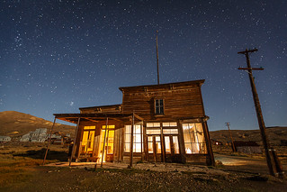
Light painting in Bodie with partial monlight
Our first of five special access workshops in Bodie State Historic Park in 2015 is coming up in only 5 weeks!

We open registration for our Bodie workshops bundled with both night photography instruction and morning interior access first, since we'd hate to turn away anyone who want wants both simply because one or the other filled up.  Not everyone wants both however, so as space permits we sometimes are able to offer separate registration for the morning or evening session separately.

So if you'd like interior or night access to Bodie at a lower cost than both together, you can join us on May 24 as follows:

     May 24 interior access (approximately 5:30 am - noon) $245: 
     https://www.paypal.com/cgi-bin/webscr?cmd=_s-xclick&hosted_button_id=RCQZ356GBZU2N

     May 24 night photography workshop only (approximately 6 pm - 1 am) $325: 
     https://www.paypal.com/cgi-bin/webscr?cmd=_s-xclick&hosted_button_id=D34XKVKWDQNAJ


For more details on the workshops, including frequently asked questions on our workshops, visit this page on my Web site:

     Bodie Night Photography Workshops     
     http://www.jeffsullivanphotography.com/blog/bodie-night-photography-workshops/

Wheaton & Hollis Hotel  in the Moonlight
Wheaton & Hollis Hotel
On May 24 the moon will set around 1 am as we're leaving the park, and it will be roughly a "first quarter" moon, 50% full.  This will be good for capturing the town well lit at night, bur it's not so bright that we can't add light of our own as well.  In addition to the lights I've been using for years, I recently bought a ProtoMachines LED2 for its range of colors as well as its fine control over intensity.  I've already taken it out for a week in March, and I'll be out practicing with it more in April and May as well.  For more examples of what Bodie is like with moonlight, here's an album on Flickr showing some past visits:

     Bodie Under Moonlight
     https://www.flickr.com/photos/jeffreysullivan/sets/72157646890561079/

Inside the Lottie Johl House
For interior access we enter as many buildings as we have time for.  On our last workshop in 2014, the ten photographers with us worked fast and entered 14 buildings!  I've found over the past few years that a tripod can be handy for the darkest rooms where I might want to use long exposures and/or exposure bracketing, but I like the fine composition control of shooting with the camera in hand.  To further extend the handheld concept, I can hold my iPhone in places and ways that would not be practical with a heavy DSLR, so some of my favorite shots now come from those low or creative angles.  You can see 100+ examples of Bodie interiors in an album here:

     Bodie Interiors 
     https://www.flickr.com/photos/jeffreysullivan/sets/72157634013024369/

Sunset in Bodie during a night photography workshop
Of course golden hour, sunrises and sunsets are not to be missed, so a general album of roughly 300 photos from the park is worth browsing as well:

     Bodie State Historic Park

It's difficult to say whether we'll be able to open up separate registration for other nights or interior sessions in 2015, it all depends upon how registration goes as the dates approach.  But I can say that May 24 is the only moonlit night we'll be in Bodie this year.  Most of the other night we have booked are on moonlit nights, so we can make the most of the Milky Way.

One tradeoff between the moonless and moonlit nights is that star trail shots may arguably be better with some moonlight, so the sky isn't completely filled with the vortex of stars.

Now in our fourth season, we're averaging 5 night workshops and 3 interior access workshops per year in Bodie. We've experienced multiple workshops in every month from May through October, with the moon in various phases and compass directions.  We'll help you make the most out of your time in Bodie!

If you're interested in both the night and interior workshops together on May 24 with a small price break, or one of our other dates in 2015, visit our main Bodie Photography Workshops page for information and to register.

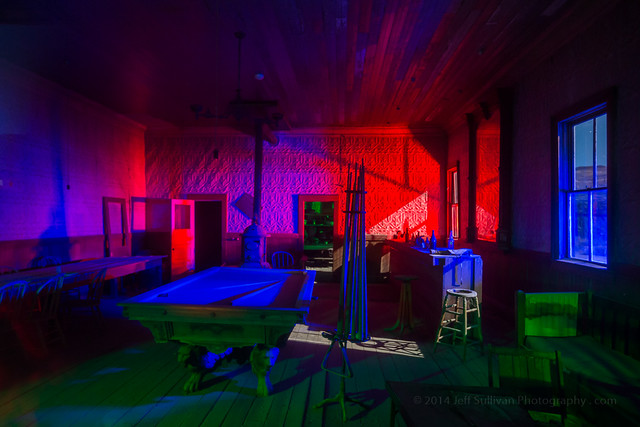
Colorful Light Painting in the Wheaton & Hollis Hotel