Wednesday, December 30, 2015

Top 10 Travel Photos: 2006

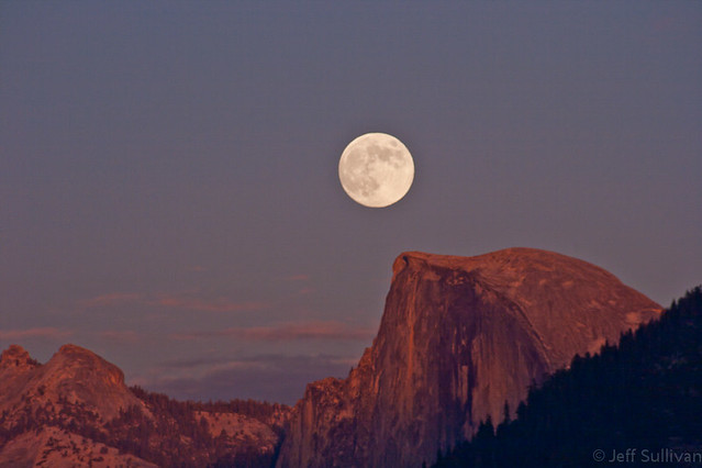
Half Dome, Full Moon
Moon Rise by Half Dome at Sunset, Yosemite National Park
I'm looking back on my last decade of travel and landscape photography, 2006 - 2015.  Here are some of my favorites from 2006.

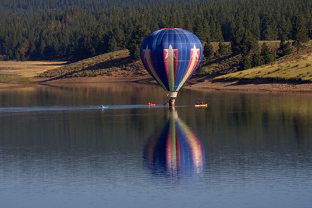
Floating
Kayakers and hot air balloon, Tahoe National Forest
 

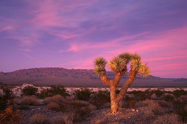
Joshua Tree
Joshua Tree at Sunset near Las Vegas

Hidden Grotto
Hidden Grotto

Solar Rainbow in Yosemite Valley
Double Rainbow in Yosemite Morning Ice Fog

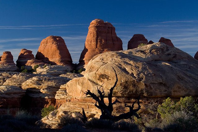
Last Light in Canyonlands
Needles District, Canyonlands National Park, Utah

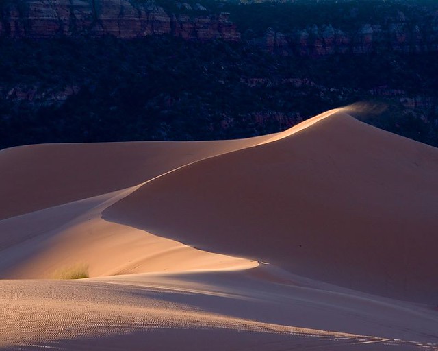
Coral Sand Dunes
Coral Pink Sand Dunes, Utah
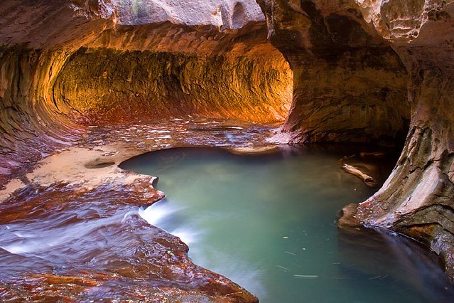
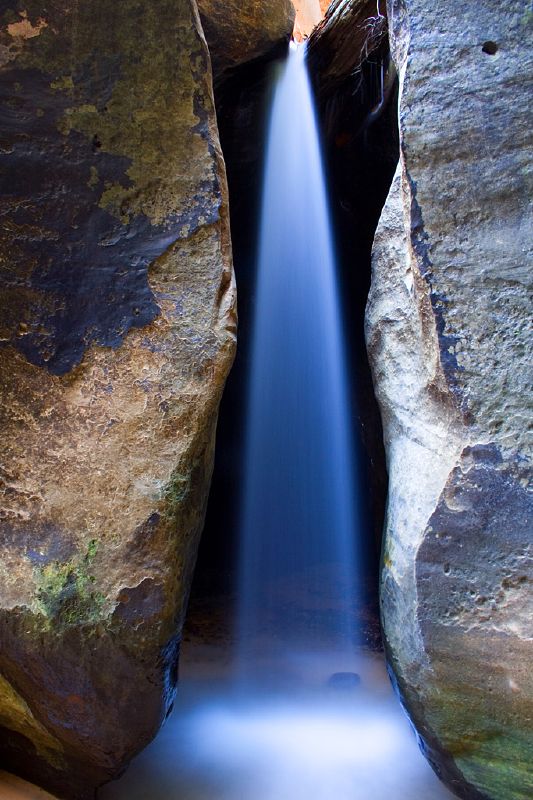
Water Cuts Rock
Water Cuts Rock, Zion National Park, Utah


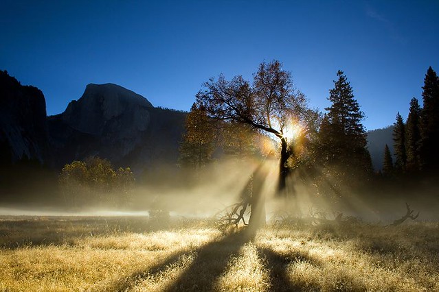
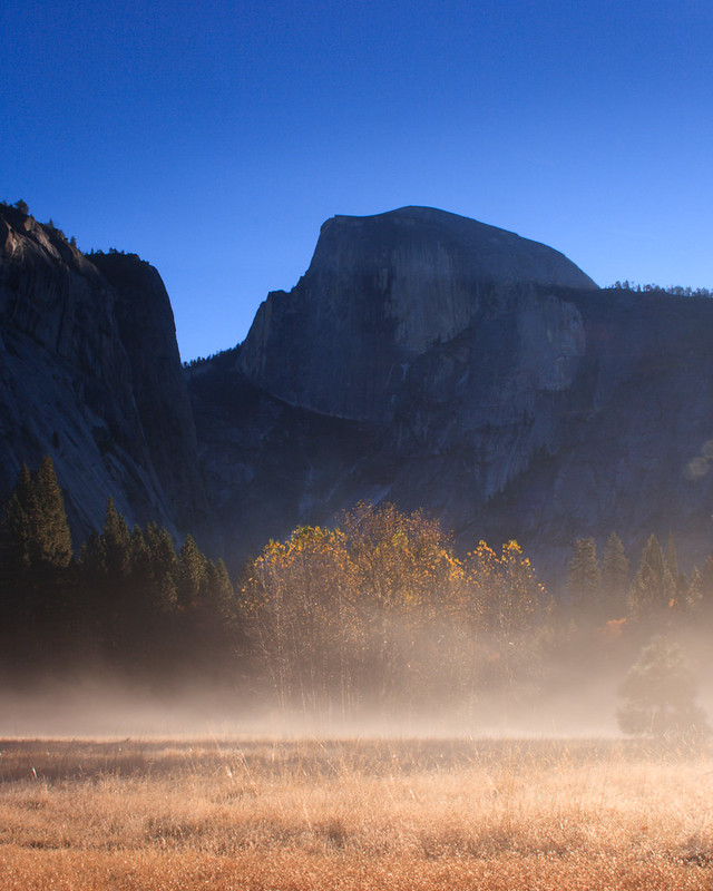
Fall Morning Mist in Yosemite National Park


Fall's Splendor
Colorful Aspen Leaves by a Spring near Mill Creek, Eastern Sierra

This was a selection of a few favorites from an album of over 45 photos from 2006. To see more of them, click on the link or photo below.

  More photos from 2006https://www.flickr.com/photos/jeffreysullivan/sets/72157648833139014

2006 Favorites

Friday, December 11, 2015

Stunning Sunset Mono Lake Moon Rise Coming December 24

Mono Lake moon rise November 16, 2013
A few times each year, the moon rises at just the right time to be visible during sunset, while there's enough light on the landscape to capture that in the photo as well.  That will happen this month on December 24, Christmas Eve.  I'm not suggesting that you ditch the family to go chase the moon, just step outside at sunset, look to the east, and you'll have one more reason for the night to be a particularly memorable one.

If you might also want to photograph the moon, I've collected some notes on this blog post that I started in 2006:

How to Plan Great Full Mooon Rise and Set Shots
http://activesole.blogspot.com/2006/11/plan-ahead-for-great-full-moon-rise-and.html

I'm not sure if we'll head down to Mono Lake.  I've been going there for decades and my kids have been going there for all of their lives, so it holds a lot of sentimental value for us. It's pretty close by, so if the weather is nice, we may head down there.  The light could be particularly nice around: 4:35 - 4:55 pm.  Ping me on social media if your'e down there, in case we're standing a few feet down the shore from each other!


Monday, December 07, 2015

Moon, Comet and Venus Continue Their Dance

Comet C/2014 US10 Catalina (blue-green fuzzy dot to the left), the moon and Venus to the right
I predicted last week that the viewing would get better all week for Comet Catalina, with an interesting configuration in the sky with the moon and Venus joining the comet this morning (above).  The three celestial bodies played hide and seek for hours after they rose, then the hazy cloud cover seemed to close, so I caught a few final exposures before picking up my tripod and heading inside.  Fortunately the very last few frames did let all three shine through the clouds just enough that I could show them to you here.

The 14% crescent moon was a lot brighter than the comet, but it'll only be an 8% sliver tomorrow morning, and its rise will follow Venus and the comet, so comet photography will be good before the moon rises, then you can try for all three again as the moon rises.

The image above was captured on a Canon 5D Mark III and EF 85mm f.1.8 lens and cropped from the larger field of view.  The 85mm lens should just fit the three objects again tomorrow, or I might go to 70mm for a wide shot like this.  For shots of the comet only, I'll probably use my Canon EOS 70D on a sky tracking mount, perhaps with a Canon EF 70-300mm f.4-5.6 IS lens to get an effective focal length of up to 480mm.

The screen shot to the right shows what the configuration will look like tomorrow.

Tuesday, December 01, 2015

Viewing Comet Catalina Gets Better All Week!


Comet C/2013 US10 Catalina at 6;10 am December 1, captured on a Canon 5DMarkIII with 85mm lens
Catalina December 1 at an effective focal length of 480 mm.
In late November I retweeted a link to an +EarthSky article describing a comet that would be brightening in the coming weeks, Comet C/2013 US10 Catalina.  This morning Comet Catalina was visible below Venus in the early morning sky to the East, as shown in the image above from 6:11 am this morning.

I also captured it at 300 mm on a Canon EOS 70D (right).  Due to bright moonlight, its tails were not easy to pick up, even at an effective focal length of 480 mm.  Over the coming week, the sky will get darker as the moon approaches its new moon phase, so the Comet and its tails should get progressively easier to see.  In the meantime, using a tracking mount would enable brighter exposures with less noise, so better results than this quick catch on a fixed tripod are certainly possible, but the best results should come as the moon gets out of the way November 8 and later, weather permitting.

Catalina with Venus & moon 12/7
Early on the morning of  December 7, there will be an interesting configuration in the sky as it rises to the left of Venus and the moon as a 14.7% crescent.  The moon rises at around 3:20 am with a zero degree elevation horizon such as the ocean followed by Venus and then Catalina around 3:40, so look for the trio clearing a moderately low land horizon around 3:45 am.  These times vary slightly with your latitude, but you can look up exact times in programs such as +The Photographer's Ephemeris or +PhotoPills.  On the morning of November 8, the situation will be similar but with the moon at 8.3%, following the earlier rise of Comet Catalina and Venus.

My 85 mm shot at the top is a four second exposure at f/2.8, ISO 3200 on a standard tripod with no sky-tracking mount, so many DSLR owners can start capturing it, whenever the sky is clear for them in the next week or two.

You can look up the comet in an app such as SkySafari+ to see exactly when it will rise in your location each morning.

Good luck with your viewing and photography!  Weather permitting, I hope to have some results to show you at some point in the December 7-14 timeframe!  Here are some of my prior comet photos on Flickr to entertain you in the meantime: https://www.flickr.com/search/?user_id=23183960%40N00&sort=date-taken-desc&text=comets&view_all=1

Friday, October 23, 2015

A Day in Grand Teton National Park, Wyoming

Lewis Falls,  Yellowstone National Park. 

Departing Yellowstone National Park to the south, you pass Lewis Falls on the Lewis River just below Lewis Lake.  There are a number of scenic stops that you can make along Jackson Lake, but campgrounds there were closed or full, so we headed towards the large Gros Ventre Campground down near the Jackson Hole Airport and the tiny town of Moose, Wyoming.  Fortunately Gros Ventre had room, and the cottonwoods were stunning in their yellow fall colors.

Smartphones are a great resource while you travel, whether looking up lodging and restaurants, using a map program to navigate, or Google Earth to look for unpaved roads to explore.  It's best for a smartphone's battery life not to keep it plugged in all the time, and to let it get pretty well discharged before charging it back up again.  There's no telling where your devices might be in the charge-discharge cycle when you stop, but when I'm not driving, I can top off my devices in a campground using a 10,000 MAh battery.  You don't expect to lose your vehicle as a power source, but on this trip I did, so it was good that I had an alternate power source to ensure that we'd have enough power to call for a tow truck!  

The LG G4 phone I was using for some photos on the trip has 32GB memory but, only 16GB after apps and OS, so it was at 1% remaining space when I took this.  The SanDisk memory stick charging here is also a Wireless Memory Stick that works over wifi, so I had it automatically back up all photos from the LG G4 as I took them.  I'd periodically delete a few photos from before the trip, since I was pretty sure that I had them at home, and they were backed up to the Wireless Stick anyway.  When I hit a hotel room every few days, I could plug the wireless stick in to my laptop like a standard USB memory.  (It could do that wirelessly in a campground as well, but I use laptops with 17" HD screens, which have short enough battery life to be more convenient to use when connected to power.)

Devices attended to, we could settle in for dinner and a glass of wine.  It was a clear day, so there was no need to rush out for sunset.  We had picked up a 2014 Larch Hills Marechal Foch Reserve, from the North Okanagan wine region in British Columbia, Canada.  I had never tasted a Marechal Foch before.  Now I have.  It had a very different flavor profile than more common red wines like cabernet or syrah.  It was more like Argentinian malbec meets "young wine" (think Beaujolais), with perhaps a trace of residual sugar.

The next morning we headed over to nearby Mormon Row and the popular Moulton Barn.  I forgot that we had passed some long, deep, muddy puddles in the road on our way to the campground the evening before, so when I came upon the first one, rather than stop and go around it seemed wiser to click on the 4WD and just power through, sheets of water and mud spraying out to the sides.

There were only a couple of people at the barn when we arrived, but it quickly got more crowded.  There wasn't anything exciting going on in the sky, so the scene of photographers was about as interesting a subject as anything.

The area just to the north of this is known as Antelope Flats, and true to its name, a buck antelope had a few girlfriends alongside the road.  It being close to mating season, at times he would spontaneously jump around and prance and dance, either to impress them or simply as an outlet for his excess energy.  If they noticed, they pretended to ignore him.
We went back for breakfast, packed up the campsite, and spent the day enjoying the changing light in Grand Teton National Park, as well as checking out the fall colors along nearby Forest Service and 4WD roads.  I wanted to drive by Jackson Hole Ski Resort and picture it with a coating of snow.  Maybe I'll return for some skiing in a few months.

Jackson Lake was nice and calm when we drove by, so there were some nice reflections of Mount Moran.  Oxbow Bend was calm as well, with the added bonus of bright yellow aspen reflecting in the still water of the oxbow.  I've encountered moose here on several occasions, and moose, elk and grizzly bears at Willow Flats just to the west, but this time people at the Oxbow Bend turnout were looking across the water for a moose they had seen over there.

Other animals were pretty much in their usual places.  Horses were feeding in a large field north of the historic Cunningham Cabin, and across the Jackson Hole Highway bison were feeding in their usual place on the Wolff Ranch.  Bison were also near the northern end of the Mormon Row barns.  In the evening, several bull elk near Teton Park Road south of Jenny Lake were bugling to warn potential challengers not to try to take their harem of cows.
There were a few sporadic clouds in the air during the day, so for sunset we found a nice spot on Jackson Lake to watch them turn color.  A slight breeze during the most intense color gave way to calmer air as sunset transitioned towards blue hour, so that phase yielded the best reflections (photo below).  We had a very nice dinner at nearby Signal Mountain Lodge.

We returned to Jackson Lake for sunrise the next day, which I describe in my next post:

End of the Road for My SUV!
http://www.jeffsullivanphotography.com/blog/2015/10/22/end-of-the-road-for-my-suv/

 
Sunset at Jackson Lake, Grand Teton National Park

Thursday, October 22, 2015

End of the Road for My SUV!

First light on the colorful aspen at Oxbow Bend, Grand Teton National Park, Wyoming (Canon 5D Mark III)
The day started like any other fall day on the road: the pink over blue Belt of Venus light leading to a  sunrise, golden hour light and calm morning reflections, fall colors, then driving to the next location on the itinerary.  Usually I don't finish the drive in a tow truck, with my SUV on the back!

Let's talk about the good news first.  Sunrise on Jackson Lake was uneventful, with no clouds, but gorgeous nonetheless.  The Belt of Venus color can be fantastic if you know how to coax its color out of the sky and into your camera, and the pastel pink and blue tones on this morning didn't disappoint.

Fortunately the lake was calm, so the colorful light show in the sky was doubled in the water.  As the sun approached on the eastern horizon, the Tetons were bathed in golden light.  So far it was shaping up to be a good day.

Not far away was Oxbow Bend (above), where colorful aspen trees were lighting up in the first rays of the sun.  There was another spot to the east which had a nice stand of colorful aspen in front of Mt. Moran as well.

Schwabacher Landing (LG G4)
A few miles south on the way to Jackson was Schwabacher Landing, which can get really crowded at sunrise, but it wasn't all that crowded by the time I arrived.  The sun was behind me, but with a little bit of waiting and some coordination with people walking by, I was able to get some shots without people or shadows in them.  The Tetons here make a long, narrow subject, perfect for the 16 x 9 aspect ratio of my LG G4 smartphone, but it was out of memory.  It has 32GB of memory, 16GB of that left for photos.  The LG G4 has a microSD slot for memory expansion, but I was using one microSD in my GoPro, and had misplaced my spare.

Fortunately, prior to the trip I had been asked to try out the 32GB SanDisk Connect Wireless Stick.  It looks like a USB flash drive that you'd plug into computers, but it connects to your smartphone via wi-fi.  Earlier in the trip I had started a complete gallery backup from the LG G4, and not only did that transfer over 4200 existing photos, it also transferred new photos as I took them.  So all I had to do on the smartphone was delete old photos, since they were already backed up.  I also filled my 64GB iPhone 5S with photos on this trip, and I was able to back up files from that as well, then delete them on the phone.

SanDisk Connect Wireless Stick with iPhone 6S+
Smartphone memory issue solved, it was on to Jackson for breakfast, grocery shopping, then I could move on to the next area to shoot.  In this case, the location change was from Grand Teton National Park and Jackson, Wyoming to Salt Lake City.  I should return home from there to prepare for a workshop in 2 weeks, but "shoulds" are for wimps.  Having invested so much time and so many miles to get that far, I could extend the trip underway to swing through Arches and Canyonlands National Parks, and continue on to Colorado to catch fall colors in Aspen, at the Maroon Bells, in Telluride and Ouray before returning home.  I'd still have a week to get ready to go back out.  Or I could wait until next year, but something could come up and it could end up being the year after that.  Heck, I may not live that long.  Life and time are precious; there's no time like the present.

But as the saying goes, life is what happens when we're busy making other plans.

Somewhere between Jackson, Wyoming and Salt Lake City, a few miles south of the small town of Cokeville, in the middle of extensive hay fields, and outside of Verizon's service area, the Explorer made a noise.  An unhappy noise.  A warning noise.  A message in the dashboard was trying to tell me something, but driving into the bright glare of the afternoon sun, I couldn't read the fading light of its aging display.  Then it was gone.  Everything was apparently fine.  Without a warning indicator, the infamous "check engine" message, I couldn't use the engine code reader to give me some clues.

The peace didn't last long.  The light came on again, I was able to read it this time, and "Low Oil Pressure" meant that I needed to pull over ASAP.  The road was elevated with essentially no shoulder.  Just as I spotted a driveway coming up across the road, the engine cut off, so I had to wrestle the now-powerless steering and brakes to cross oncoming traffic and bring the vehicle to a stop.  The stall could have been an engine safety shutdown, but I would need to have it towed to somewhere where a mechanic could assess the failure.  Fortunately Lori Hibbett had flown in to Seattle to join me earlier in the trip, and her AT&T phone had one bar of service, so we could call for a tow.

It was late on a Friday afternoon, so Salt Lake City 150 miles to the south would be the best option for finding a mechanic working on a Saturday.  Thank goodness for premium roadside assistance plans covering tows up to 200 miles!  Not being able to look up shops or do a lot of calling to identify a shop open Saturdays, we had the SUV towed to the Courtyard Marriott at the airport so we'd be able to catch a shuttle to the airport and rent a car to get around.  When we arrived, I called every mobile mechanic in town, so see if one would come out late on a Friday or early Saturday.  No one called me back Friday, even the places which supposedly worked 24 x 7, but Saturday morning I did get a single call back, and the mechanic was there less than an hour later.  At first he was optimistic that the oil pressure sensor may have failed, since it had clearly been worked on, but he eventually tried to turn the engine with a large wrench, and it was seized.  The oil was topped off and there was no coolant mixed in from a broken gasket, so the mode of failure most likely had to do with the oil pump itself, possibly the timing chain which drives it.

Although I had kept the vehicle in immaculate shape to get me in and out of remote places, and I had recently put another $1000 into it to hopefully get another 100,000 miles out of it, the book value was only $2000 and a rebuilt engine would cost more, so it was a total loss.

One shuttle to the airport and one rental minivan later, we were leaving at noon for the 8-hour drive home.  Of course the minivan had weather stripping on both sides of the windshield that whistled loudly over 50 MPH, at what sounded like the exact frequency of my SUV's warning beep!  A couple of stops and a few feet of gaffer's tape, and the whistling minivan was silenced.

The following day I was able to locate a place that would buy my vehicle using its pink slip in Reno, but pick it up in Salt Lake City a couple of days later.  Done, except for the fact that I lost the vehicle and its $2000 value, plus expenses associated with the breakdown.  I guess that I need to come up with my next project, and include a new vehicle in the budget for it.

After the trip, I bought an Apple iPhone 6S+ using the Apple Upgrade Plan, and the SanDisk Connect Wireless Stick worked like a charm with that as well.  Although the USB connection is mainly to keep the Wireless Stick charged, but I was pleasantly surprised to discover that when I plugged it into my laptop, it worked like a USB drive as well, and I was able to copy photos from all three smartphones directly to the laptop.

Although we think of hard drives as being a weak link in our photography toolkit (right behind vehicles), smartphones also fail, often by being dropped in water, so I'm glad to have to have an easy backup solution for the photos on mine.  If you think that you might want to pick up a SanDisk Connect Wireless Stick for storage expansion, backup, or wireless transfer of files among your wi-fi capable devices, SanDisk has given me a coupon code to offer you 30% off: https://goo.gl/1HRPrF

It handles a lot more than smartphones and photos, you can stream music or HD movies to up to 3 devices at once.  Learn about the product here: https://goo.gl/Gp0mBm or watch a product video: 
https://goo.gl/SfTNNc 


This is a sponsored conversation written by me on behalf of SanDisk . The opinions and text are all mine.
Final Leg Home, Without My SUV

Uh oh, "Low Oil Pressure"!
After a breakdown on Friday and a diagnosis by a mobile mechanic on Saturday, it was time to drive from Salt Lake City, Utah back to Topaz Lake, in the Eastern Sierra on the California/Nevada border.  We reserved a rental full size SUV at one agency to fit our gear in, but it was unavailable when we showed up.  They tried to pawn off a RAV4 as full size, then substitute a pickup truck at 2X the price, but we eventually found a minivan elsewhere at a much more reasonable rate.

From our refuge at the Courtyard Marriott near the airport, we were on the highway west in minutes.  Crossing the rest of Utah and all but the last few feet of Nevada would be a trip of over 550 miles, about 8 hours.  First you pass south of the Great Salt Lake.  We had to pull off near a Morton Salt facility due to a very loud whistling sound, caused by the weather stripping on both sides of the minivan windshield.  Copious amounts of gaffers' tape later, the musical vibrating minivan was silenced.

Next you cross the Bonneville Salt Flats, for about an hour.  Near the far end is where the Bonneville Speedway is, where drag races are held, land speed records are broken, and many car commercials are filmed.  This week none of that would be happening, since a heavy rain had left standing water on much of the salt flats, and water-softened rock salt elsewhere.  There were reflections in the water and mirage reflections int he distance, and it was impossible to tell the difference between the two until you were close to the area that you thought had been flooded from a distance.

From the Nevada border to Wells there were some interesting mountains.the Toano Range and the Pequop Mountains. From Wells you can see the colorful aspen-decorated Humboldt Range, where I've camped at Angel Lake in the past.

Immediately after Wells was the exit for Deeth, where I encountered interesting and chaotic weather on a photography trip to the Rocky Mountains in the fall of 2006.

Next you can see the Ruby Mountains, where aspen appeared to be in peak color.  It was tempting to look towards Nevada's best-known leaf-peeping site or Lamoile Canyon and consider the trip out and back from Elko, but the drive today would be long enough without adding side trips to it.
The center of the state tends to be pretty dry and uninhabited, which is either beautiful or barren, or both.  It's not hard to see in the middle of the state how important mining is to the economy, as you pass mining machinery for sale, roads with names like Newmont Mine Road, and the mines themselves, with mountains of tailings growing toward the sky.  The boom and bust cycles as people chase one resource or another also tend to leave some interesting abandoned towns and facilities that can be interesting to explore.

We exited US-80 by Fernley, home to a large Amazon.com warehouse, and continued through Yerington, where we were treated to a moonrise during sunset.  The following evening the moon would rise entering a total eclipse.

The trip started September 7 with Lassen Volcanic National Park, passed through the Olympic Peninsula, to the Canadian Rockies, then down the Rocky Mountains to Grand Teton National Park.  It ended September 26 with the return from Salt lake City.  I was hoping to add a week-long extension to Colorado to enjoy fall colors there, but life is what happens while you're busy making other plans.

Returning early would give me time to prepare for my two-night photography workshop in Bodie State Historic Park.  Besides, if I'd have to be replacing my SUV, I had that unplanned expense to deal with... good thing I didn't have the breakdown another 600 miles further from home.  But if you do take long trips, I can't say enough for roadside assistance plans which give you the protection of a tow up to 200 miles!

I'm going to post the story of this trip on my blogs in installments, in reverse order, so that once they are all posted, they can be read straight through in chronological order to the end, no matter what section new readers may arrive in.  Here's the new post describing the prior day, leading up to the loss of my SUV: http://activesole.blogspot.com/2015/10/end-of-line-explorer-road-trip-September-2015.html

Total lunar eclipse, as seen from home at Topaz Lake on September 27, 2015

Planets, Orionids and Zodiacal Light

Meteor with Venus, Jupiter and Mars rising in zodiacal light during the Orionids, October 22, 2015
Who saw or photographed some Orionid meteors over the last night or two?  In the photo above, a meteor crosses over the path of Venus, Jupiter and Mars, rising in zodiacal light during the Orionid meteor shower around 5 am this morning, October 22, 2015.

Although the streak is clearly a meteor (note the characteristic green color), technically it's not an Orionid, since the radiant point for the Orionid meteor shower is out of the upper right corner of the frame.  So this meteor is traveling at nearly a right angle to what its trajectory would be if it were one of the Orionids.

It may however be a Leo Minorid meteor, since its radiant point is to the left of Venus Jupiter and Mars this morning.  The Leo Minorid meteor shower peaks the morning of October 23, but it is a minor shower with an estimated 2 meteors per hour, but minor showers sometimes have an unexpectedly high rate, so tomorrow morning could offer a surprise from the Leo Minorids along with after-peak Orionids.

There are also random, sporadic meteors, particularly in the early morning, as your position on the earth rotates to the leading side of the earth as it travels through space rotating around the sun.

The Zodiacal light is sunlight shining off of dust in our solar system, the light tilted up from the lower left in the photo above.  You can experience the Zodiacal light, or false dawn, this time of year when a a pyramid-shaped glow can be seen in the east an hour before dawn's first light (or 80 to 120 minutes before sunrise). This light is caused by sunlight reflecting off of dust particles in space in the same plane as earth and can resemble the lights from a city. It is tilted to follow the same ecliptic plane that the planets travel in.  Zodiacal light is best seen under dark skies, in places with minimal light pollution.  You can catch the Zodiacal light for another 2 or 3 mornings this month, but after that the moon will be too full and it will no longer set early enough to leave you with a dark enough sky to see this pre-dawn light.

You can see the Zodiacal light as the planets rise in this time-lapse video captured this morning before and twilight light started to brighten the sky:


Venus, Jupiter and Mars in Zodiacal light during the Orionid meteor shower this morning


Monday, September 28, 2015

Total Lunar Eclipse September 27 2015


Total Lunar Eclipse September 27, 2015: wide angle time-lapse and 640mm effective live action footage from the total lunar eclipse last night.  The partly cloudy forecast and webcam images didn't look all that promising in the Eastern Sierra yesterday afternoon, so I ditched my plans to pursue one of several compositions that I had worked out, and I stayed home to see if the moon would make any appearance at all.

I watched for about an hour after it was supposed to rise at 6:44, but there was no sign of it, so I left my camera shooting a sequence of images for a time-lapse video, and I went back inside.  A few minutes later, the fully eclipsed moon was visible through a break in the clouds, from 7:56 - 8:06.  I came back out a while later, but the moon was behind the clouds, so I didn't know that it had made a brief appearance until I reviewed the images later!


As the moon was more than halfway through the partial, umbral phase coming out of total eclipse, it emerged from the clouds and starting lighting up the clouds and landscape with increasingly bright light.

As the face of the moon returned to fully lit in the penumbral phase of the eclipse, there was a nice halo of color around the moon, so I set up a second camera to capture that.  I used my Canon EOS 70D with the EF 70-200mm f/4 IS L Series lens and a 2X teleconverter, for an effective focal length of 640mm.  The clouds were moving pretty quickly, so I also captures dome live video of the clouds moving across the face of the moon.  I had the camera on a sky-tracking mount, so the moon remains essentially still in the frame.

I didn't shoot where I expected or capture what I anticipated, but by being there to catch changes in the weather, I captured some interesting results.


Sunday, September 27, 2015

See the Supermoon Total Lunar Eclipse Tonight!

Lunar Eclipse April 4, 2015
September 27, 2015, 6 pm -  See the "supermoon" total eclipse tonight!  For watchers in the Rocky Mountain states, partial eclipse begins at 7:11 pm local time, so look outside now!

For those of us on the West Coast of North America, moon rise occurs closer to sunset, in a little over 30 minutes.  Here in the Eastern Sierra, local moon rise is around 6:44 pm and sunset is around 6:47 pm, depending upon how far north or south you are. The moon will clear the horizon to the east right around sunset, well into its partial eclipse phase, and be fully eclipsed from 7:11 - 8:23 pm. Then as the moon exits total eclipse, it will be in a partial eclipse for over an hour more.

For more specific eclipse phase timing in your region, see the article at www.timeanddate.com/eclipse/lunar/2015-september-28

---
Photography notes from the April 5, 2015 lunar eclipse:

Lunar eclipses are a fun challenge, in part because they push the limits of your equipment.  The image above was captured at 4:51 am during the April 4 lunar eclipse this year, about 6-7 minutes before totality, so there was a sliver of bright sunlight on the moon.

The Canon EF 70-200 f/4 IS lens was well focused, but shooting any lens at it's maximum aperture tends to result in slightly less sharp images.  Adding more glass elements such as the 2X teleconverter further challenges sharpness.  Adding a teleconverter also reduces the f-stop, in this case 2X to f/8.  I wanted to stay at or below below 1 second exposure time to reduce motion blur, and at ISO 1600 I could use 0.6 second.  The high ISO also creates a little bit of noise, which can also challenge fine detail.

I had changed my shooting location when the weather forecast made the original ones I had identified look less attractive with below freezing temperatures, high winds, and possible clouds to obscure the eclipse.  I decided to just catch what i could from home.  I was shooting a time-lapse sequence, and shooting at 400mm I had room to lengthen the exposure time as the moon darkened, but  and the moon set just before totality.

I had my Canon 70D with a Canon EF 70-300mm f/4-5.6 lens on a star-tracking mount to capture a time-lapse of the eclipse progress without the moon moving out of the field of view.  at 300mm the effective focal length was 480mm, but shooting wide open at f/5.6 that lens was a little softer than the EF 70-200mm and 2X teleconverter combo, even with the moon's relative motion taken out of the equation.

I was basically using the 5D Mark III to measure and track exposure as the eclipse progressed and the moon illumination constantly changed.

The 70D / 70-300mm combo is a lot lighter than the 5Dmkiii / 70-200mm / 2X combo.  Heavier camera bodies and longer, heavier lenses can sometimes cause various problems with sky tracking mounts, but it may be worthwhile to test the 5Dmkiii /70-200mm / 2X setup on the sky tracker and backing off of the maximum aperture and a stop or two on the ISO to get more sharpness and less noise, lengthening the exposure time.

Friday, August 14, 2015

Perseid Meteor Shower 2015

2015-08-14-1439588880-6591901-StarStaX__46A8412_46A8817_lighten201.jpg

Comet Swift-Tuttle only passes the earth and circles the sun once every 133 years, but the earth passes through its trail of dust every year.  The debris field is large, so Perseid meteors may be seen on nights from July 17 through August 24.  The earth passes through the most dense portion of the comet's dust trail on the night of August 12-13, so that is when the peak, or maximum hourly rate of meteors, is seen.

On any given night, the sun sets as your position on the earth rotates away from the sun, then around midnight you rotate to a point directly opposite the sun. As the earth also moves in its orbit around the sun, your position on the earth is just starting to rotate to the side of the earth leading its movement through space, which collides with more debris. So meteor rates go up starting at midnight. At dawn you're approximately in the middle of the face of the earth as it flies through space, so meteor rates continue to climb slightly towards dawn. So the best bet in the evening is after midnight, in the last hours of darkness before the dawn's oncoming light brightens the sky.

This year I pursued the Perseids on the mornings of August 9, 11, 12 and 13. The best viewing was on the peak morning of the 13th, as expected. The composite photo above shows many of the meteors that my camera picked up over the course of nearly four hours.

I also assembled a time-lapse video that condenses several hours of meteor activity into seconds of video. You can see it on Vimeo here:


Perseid Meteor Shower 2015 from Jeff Sullivan on Vimeo.

Not everything that moves in the video are meteors; the meteors are the brief streaks of light, the slower ones are airplanes.  As you see the Milky Way and stars move, that is from the rotation of the earth. You can also see smoke from forest fires.

According to Wikipedia, Comet Swift–Tuttle has been described as "the single most dangerous object known to humanity". But don't worry, its next close encounter with the earth isn't expected until the year 4479. With a nucleus 26 kilometers across, if there were an impact, the force is estimated to be 27 times larger than the one which formed the Chicxulub crater beneath the Yucatán Peninsula in Mexico, which is believed to have caused the extinction the dinosaurs.

Doomsday preppers take note, you only have 2464 years to get ready!

Monday, August 10, 2015

The 2015 Perseid Meteor Shower is Underway


Comet Swift-Tuttle only passes the earth and circles the sun once every 133 years, but the earth passes through its trail of dust every year.  The debris field is large, so Perseid meteors may be seen on nights from July 17 through August 24.  The earth passes through the most dense portion of the comet's dust trail on the night of August 12-13, so that is when the peak, or maximum hourly rate of meteors, will be seen.  The rates will also be high throughout the August 11 - 14 period, so you can look for Perseid meteors any or all nights this week.

Below is a video that I assembled in 2009 from several nights photographing the Perseid meteor shower.  It is a time-lapse video that condenses several hours of meteor activity into seconds of video:


Not everything that moves in the video are meteors; the meteors are the brief streaks of light, the slower ones are airplanes.  As you see the Milky Way and stars move, that is from the rotation of the earth.

You can also see haze that is smoke from forest fires that year.  I may have similar challenges this year due to the fires currently raging during California's drought.  Already the photo I captured above from last Saturday night is darker than usual, due to smoke from a wildfire.

Sunday, August 09, 2015

Find the World's Coolest Toilets for Lonely Planet


If you are on the photo sharing site +500px , they have put out a call for licensing bathroom pictures on behalf of +Lonely Planet​.  Their example is an outhouse photo, so your favorite outhouse photos from Bodie should be fair game!  

For the photographers joining me in Bodie this Saturday, look for opportunities in golden hour light, without the daytime crowds as we access the park before it opens and after it closes.


The contest is much broader than just outhouses, so see what other ideas you can come up with as well.  You can find more details on the "Find the World's Coolest Toilets for Lonely Planet" opportunity here.

Monday, August 03, 2015

Planning Sunset and Sunrise Landscape Photography with TPE 3.3

Sunrise at Topaz Lake on the California / Nevada Border
Planning landscape photography has traditionally been a process of considering a combination of location and weather.  If you have a general understanding of the geography of a region, you could look at weather forecasts a few days ahead of time and anticipate where and when the best photographic opportunities might present themselves.  During the course of a day you could modify your plan even further, and decide where to be for sunset based on where you see the best cloud formations developing, and where enough breaks in the clouds might let light through.

In recent years the availability of maps and satellite imagery online in programs like +Google Maps made the location planning easier.  The availability of fairly detailed weather forecasts days in advance through the National Weather Service made the choice of where to go in a region a little easier.  Apps like   +The Photographer's Ephemeris added lines to show the direction of the sun and moon at any time of day or night, so you could anticipate the exact sun rise and set time, general sunlight illumination during the "golden hour" before sunset and after sunrise, as well as anticipate the location of the moon.

Forecast for August 2, 2015
The latest version 3.3 of The Photographer's Ephemeris uses the SkyFire service to check weather forecasts to predict sunrise and sunset color, and show a color-coded overlay on a map of the region your're in.  The more red the color, the higher the probability of sunset color,  The mroe blue to clear it is, the lower the probability. You can see the forecast two to four days in advance depending upon what level of service you'e enrolled to receive.

Another handy feature of SkyFire is to compare forecasts for a list of favorite locations that you've saved, so you can decide between locations to drive to, in order to have the best odds of a nice sunset.

I've tested these features a number of times now, and they do well at predicting when there will or won't be sunset color.  Weather forecasting is notoriously imprecise, so of course you can't predict the direction or extent of the color, but so far the correlation between the SkyFire forecast and the outcome is impressive.

Here's the sunset that actually occurred with the forecast shown to the right for August 2:


Multi-day SkyFire forecast on TPE
The multi-day SkyFire forecast format is shown to the right. The bright red box showed a potentially vivid sunrise opportunity at Lake Tahoe.

The SkyFire service is an optional in-app purchase for TPE, with prices as follows:

Top In-App Purchases

  1. Location Synch (1 year)$0.99
  2. Skyfire Plus (3-months)$14.99
  3. Skyfire (3-months)$9.99

There is also a new location synchronization feature, which finally enabled me to sync my iPhone TPE with my Windows TPE.  There was a procedure to do it before that I had not been able to complete.  With this new method it was quick and simple.

If you don't already have TPE, here's a link that you can use to find it in the Apple iStore:

The Photographer's Ephemeris - Crookneck Consulting LLC

Crookneck Consulting also offers a Photo Transit app which enables you to anticipate what focal length you'll need to capture a certain field of view to get the shot that you want:

The Photographer's Transit - Crookneck Consulting LLC

I'm also testing TPE 3.4, so I'll probably have some details on that for you shortly!

Another sunset accurately predicted by SunFire