Showing posts with label National Park. Show all posts

Tuesday, December 26, 2017

Outdoor Photographer Magazine Iconic Locations Winner

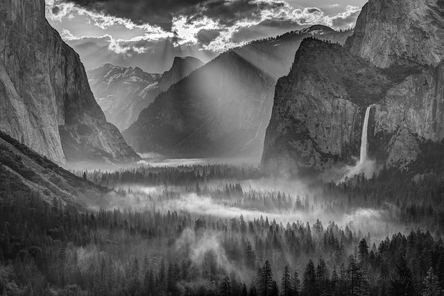
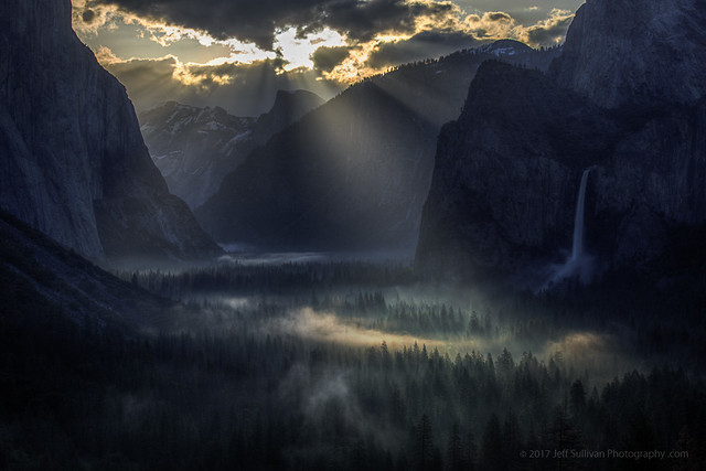
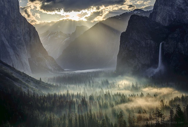
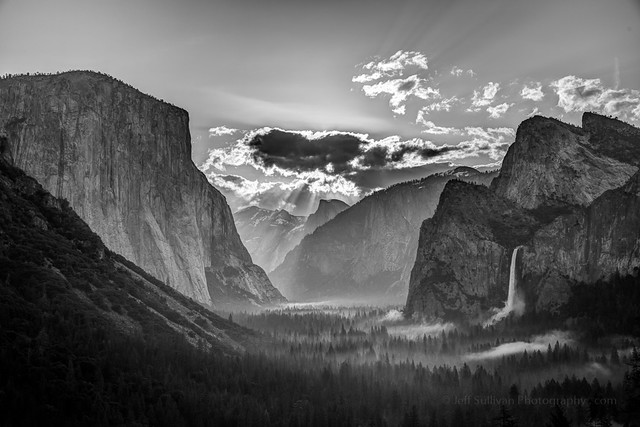
Yosemite Morning Sun Rays

Thank you Outdoor Photographer Magazine for selecting my photo as the winning image for your Iconic Locations challenge!  See the write-up on their site for more information on how the image was created:
https://www.outdoorphotographer.com/iconic-locations-assignment-winner-jeff-sullivan/

OP was kind enough to share the image on their Facebook page and Twitter timeline as well.
Here are some more images from that amazing sunrise during my photography workshop in early May:

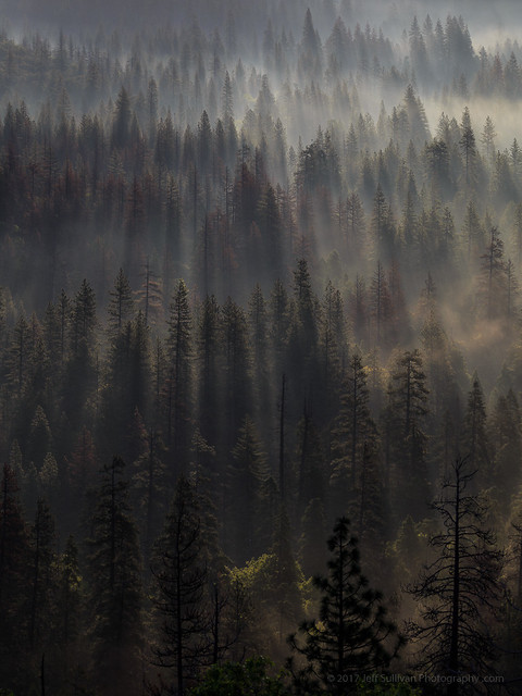
Yosemite Light Rays on Valley Fog

Light Rays On Morning Fog

Yosemite Valley Morning Light

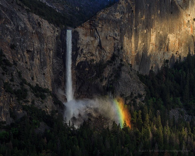
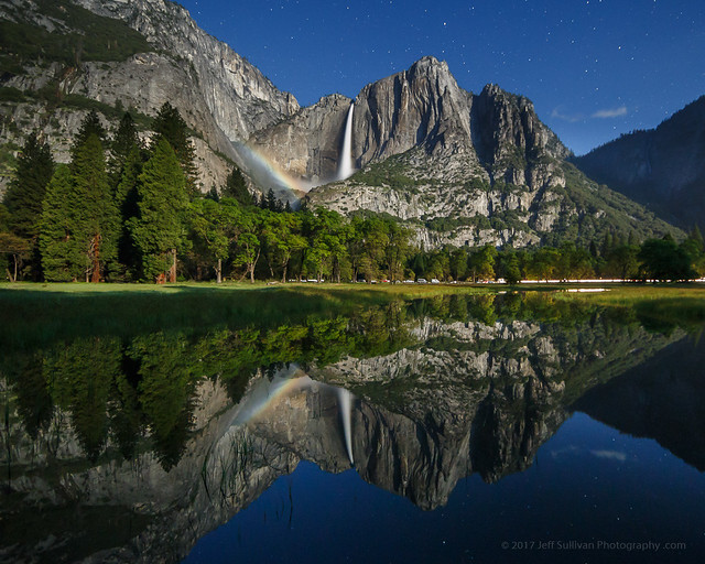
Rainbow in the Mist Moonbow Reflections 2017
Climber Lights on El Capitan

Morning Fog in Yosemite Valley

See my Web site for many more images from my 2017 photography workshops: www.JeffSullivanPhotography.com

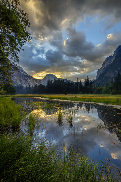
Half Dome Morning Reflection

Wednesday, June 28, 2017

Tioga Road in Yosemite National Park to Open Thursday, June 29, 2017

Milky Way as seen from Tioga Pass Road at 10:32 pm, June 21, 2017.

Yosemite News Release
June 27, 2017 4:00 pm
For Immediate Release

Tioga Road in Yosemite National Park Open to All Vehicular Traffic Thursday, June 29, 2017

Tioga Road will open for Bicycle and Pedestrian Use on Wednesday, June 28, 2017

The Tioga Road in Yosemite National Park (Highway 120 through the park) will open for the season to all vehicular traffic beginning at 8:00 am on Thursday, June 29, 2017. There will be limited visitor services available from the Tioga Pass Entrance Station to Crane Flat. Tioga Road will open for bicycle and pedestrian users at 8:00 am Wednesday, June 28, 2017.

All visitors on the road are encouraged to use caution as there may be dirt, debris, and water flowing over sections of the road. Visitors are encouraged to keep an eye out for maintenance vehicles working on the roadway.

There will be minimal services available along the Tioga Road for several weeks. There will be no drinking water. Visitors should use the vault and portable toilets located along the roadway to help protect water quality in the Tuolumne River watershed. Food service and lodging are not available along the Tioga Road. There is no mobile phone service at this time and 911 emergency calls will not be operational. There are no gasoline services available along Tioga Road. Visitors can purchase gasoline in Lee Vining and at Crane Flat.
For maps and visitor information, visit the Tuolumne Meadows Wilderness Center, open from 8:30 am to 4:30 pm, the Big Oak Flat Information Station, the Yosemite Valley Visitor Center, and the Mono Basin Scenic Area Visitor Center in Lee Vining.
Tamarack Flat Campground is the only campground that is currently open along Tioga Road. This campground is first-come, first served and fills early in the day.   

Anyone planning to hike or backpack near Tuolumne Meadows and in all high elevation areas of Yosemite should be prepared for winter hiking and camping conditions. Trails are still impacted by snow and ice. River crossings are high and swift moving. There are several high water areas currently impacting the Pacific Crest Trail (PCT) and the John Muir Trail (JMT) in Yosemite National Park. Trail conditions may vary at any time.

When driving in the park, motorists are urged to drive slowly as bears and other animals are active and may be present on the roadway.
For updated 24-hour road and weather conditions for Yosemite National Park, please call 209-372-0200 and press 1.

Monday, May 02, 2016

April Road Trip to Death Valley

Natural Bridge
You may have noticed that I'm obsessed with death. Death Valley National Park, that is! I grew up in New England, just about as far from the desert as you can get in America, so in my current quest to explore the largest national park in the Lower 48 States, I must be making up for lost time. 

Mesquite Flat Dunes
Fortunately, currently living in the nearby Eastern Sierra region, I'm only 3-4 hours from a couple of park entrances, so I can indulge in my desert yearnings frequently. I usually visit once or twice in the Thanksgiving to New Year's Day time period, then again in February and March as the wildflowers start to bloom. But as spring continues and Death Valley starts to really warm up, I like looking for storms and bouts of cooler weather, in case I can slip one or two more visits in before it gets too hot. 

In April 2016 I could see a storm front approaching in the weather forecast. Daytime high temperatures would drop into the 80s.  I'm currently working on a detailed photographer's travel guide to the park to be offered in the +SNAPP Guides app, so I threw my camera and camping gear into the car, and headed to the park with a list of the sites I wanted to explore or revisit next.

I hiked to a natural bridge, and enjoyed great views with sunlight streaming through clouds. I explored stone-walled buildings at an old mining town site, and found wildflowers thriving at higher elevations than on past visits this year.

I met a Subaru coming out the wrong way from Titus Canyon, apparently deciding that "high clearance" meant higher then they had. The worst part of the road is about halfway through the 24-mile loop, so drivers that wait that long have a lot of wrong-way driving to do. Sometimes they're in a hurry to get out, so they come flying around blind turns!

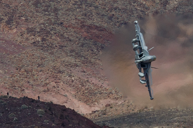
On the edge of a canyon, two jets saw me with my camera, so they took two passes each direction up the canyon, turning and shooting up sharply right in front of me, so I was able to get some great shots. They were very fast, very close, and very loud!

In Salt Creek, the water was slightly higher than normal, so the pupfish were exploring down to the parking lot, feeding in the flooded margins before low water forced them back into their normal cramped habitat space. Normally they're a little skittish, but their quest for food prevailed, so when I held my iPhone out over the water, one came over and posed for a portrait.

On one evening, I caught a sandstorm over Mesquite Flat Dunes, back-lit with golden sunlight by the setting sun.

On the way home, sunset light was lighting up rain showers at Mono Lake. It was an eventful and productive trip. I can't wait to return!  In the meantime, I've uploaded the latest batch of photos to the Death Valley 2016 photo album on my +Death Valley Workshops page on Google+.

If you might like to join me in Death Valley sometime, my spring 2016 workshops are done for the season, but I can add a session in mid-December if there's sufficient interest: Death Valley Photography Workshops.

Jellyfish Cloud
Sunset rain showers over Mono Lake

Wednesday, April 20, 2016

Photograph Jets Up Close in Death Valley

High Speed Selfie
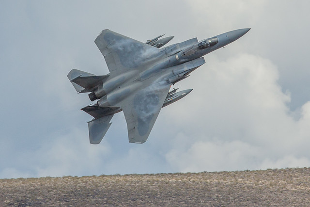
Water vapor condenses on the wing of an F-15C from the 144th Fighter Wing of the +Air National Guard in Fresno
I've encountered jets in this canyon in Death Valley by coincidence a few times over the years, so I mentioned them on page 130 of my "Photographing California" guidebook, but I've only recently sat around and waited for them to arrive. The first time I showed up at 4:30 pm and waited for a couple of hours, and was skunked. I later talked to someone who had arrived at 3:30 pm, and saw three passes in 45 minutes before leaving at 4:15 pm.
The second time I waited from dawn, nothing happened until a single plane went through at 9:50 am. Nothing happened for another hour, then a pair of F-15C jets from the California +Air National Guard went through it in each direction, twice! They seemed to spot the camera on the first run, then on the next three runs the lead plane pulled up sharply right at my location partway down the canyon, to be pulling a lot of Gs and turning up out of the canyon sharply directly next to me. The pilot appears to be looking at the camera each time, and I can't think of many reasons to end a run up the canyon early, in both directions, so it sure seemed like he was setting up selfies. When he was pulling the most Gs, water vapor trails formed as trailing lines in the wingtip vortices, and more vapor formed on top of the wings. Having heard that photographers fly over from Europe to spend a week sitting all day waiting for the jets, and they report 7 to 9 per day, I had my 9 and figured that I had done well. For some reason, Mondays were considered to be less promising, so I might not see any more planes that day. I picked up my tripods and started moving towards the car, and more planes came! It was like that until I had to leave by noon. I'd throw the tripod over my shoulder and another jet would come. A couple of guys from the adjacent campsite in the Stovepipe Wells campground the night before showed up and saw a jet go through. A few random people watched one go by from time to time. A busload of children on a field trip showed up, their wait was no more than 10 minutes, then a jet went by and they left. It seemed as if perhaps they came from a town nearby and had been able to coordinate with the pilot, perhaps a parent of one of the children. Having been skunked on a prior visit then rewarded with a flurry of activity after a few hours of boredom, I can't make generalizations yet about your odds of catching jets flying up canyons in Death Valley, but apparently if you are persistent enough, they may eventually come. That's when you'll find success, when preparation meets opportunity.

F-18 Showing Off
Water vapor condenses at the wingtips and over the wings of an F-18 in a high-G turn

Thursday, March 31, 2016

Revelstoke: Heli-ski Capital of the World?

Revelstoke National Park, British Columbia, in September
When I passed through the picturesque town of Revelstoke, British Columbia in September, I know that it was a quaint little ski town, with world famous helicopter skiing opportunities in the surrounding mountain ranges. I had grown up seeing the Monshees and Selkirks highlighted in the ski movies by Warren Miller (now +Warren Miller Entertainment), so it was great to be seeing the place in person, a bit of a pilgrimage for a powder skier. I was pleased to find that the town hadn't been overrun with condominiums and other development, like so many other North American ski towns. It's a real town, with actual inhabitants. What a concept!

Upon arrival in town, it was nearly sunset, so I found a pond for reflections. There wasn't much beyond the sky and reflection for a subject however, so I moved to a view where I could see one of the surrounding peaks with the last light of the sun on it.

The hotel I was staying in had a lot of skiing images on the wall, so I walked around admiring them. As it turned out, it was the base for CMH, Canadian Mountain Holidays, one of the well known heli-skiing operations in town. I've skied all of my life, and I had avalanche training along with the 12-week Outdoor Emergency Care course given by the +American Red Cross when I was on the National Ski Patrol at +Squaw Valley Resort for a few years.  With ski season on the way, I was tempted to fill out a job application! Somehow I resisted the temptation. Maybe next year....

What I didn't know at the time was that my brother would be skiing in Revelstoke this winter. With the American dollar strong, he and his friends looked into dates and prices, and decided to go with +Selkirk Tangiers Heli Skiing.  I couldn't join them this time, but at least I know what I missed, via his +GoPro video from the trip:


I have to admit that I'm more than a little jealous... it's definitely a "bucket list" trip that I'd like to take sometime!

 The next day there was a dusting of snow on the surrounding mountains, but the storm was already breaking up, so it was a perfect day to head into adjacent Revelstoke National Park to enjoy the views. I was planning on heading in the general direction of Lake Louise and Banff, so I couldn't go on any long hikes.

 As it turned out, the scenery was spectacular as I headed east, and the weather kept the conditions interesting for photography, so it was a great day to be on the road. I passed a few national parks that I didn't have time to explore; I'll definitely have to allocate more time to enjoy the area on my next pass through.


#roadtrip #travel +Tourism British Columbia +Visit Canada

Wednesday, February 24, 2016

The Almost Super Bloom in Death Valley

Reports are still coming in strong on the excellent wildflower bloom underway this month in Death Valley National Park. These photos are from my scouting trip through the park February 7-11.  
Desert Gold and Sand Verbena in Death Valley
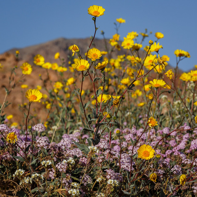
Desert gold and sand verbena


As of February 9, some flowers were past prime, others were vigorous, others were just emerging.  Some rain fell a week later, which should extend the season for this year's already healthy crop.

Ashford Mill to Jubilee Pass
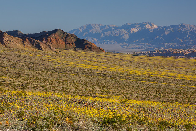
Looking from the Ashford Mill area toward Jubilee Pass
In spite of the hype in the media and on social media, the park is NOT calling it a "super bloom" yet, but in the recent YouTube video titled "Death Valley Exposed: Wildflowers - February 2016", park ranger Alan Van Valkenburg does imply that it has the potential, perhaps with additional rains: “If you get the chance to see a bloom in Death Valley, especially a super bloom, you should take the opportunity to see it because it could be a once in a lifetime opportunity.”

There was a less dense area of desert gold north of Furnace Creek, up to and through the Beatty Cutoff area. Most other areas were looking basically lifeless, even though they may have received a lot of rain. The timing of the rain may not have been early enough for the plants to be far along yet, and once they get going they do need additional rain to keep the growth going. Rain last week in mid-February might have helped extend the life of these areas, and the growth of others.

Overall the spring wildflowers in Death Valley are usually very sparse, and peak in March, so outside of the areas I just described, the season seemed normal: nothing much should be expected in early February. The initial bloom may or may not be followed by decent blooming elsewhere. We saw healthy growth in November in areas such as the narrow last portion of the Dantes Peak road, so we were expecting the adjacent Greenwater Valley to be going nuts when we returned in February. Instead, it looked even weaker than last year... not much going and much less promising than expected.

So in much of the park, as the initial strong bloom of desert gold fades, the situation may resemble a more normal year, where you can find wildflowers, but it requires some hunting and probably high clearance, if not 4WD.

Here are a few more photographs from my visit to supplement the ones I included in my recent trip report. I drove the park from Dumont Dunes all the way out the top at the town of Big Pine.


Desert gold extensive but thin looking north from the Salt Creek turnoff north of Furnace Creek


Not far from Ashford Mill, south of Badwater


The southern end of Harry Wade Road wasn't as productive as the north end and and the Ashford Mill area.  Many of the flowers were wilted from heat, and didn't look like they were going to last much longer, especially the brown-eyed primrose.


Fiats don't float!  Not in water, not in sand.
Unpaved roads in Death Valley are marked for high clearance or 4WD vehicles for a reason.


It's not all about the desert gold.  Look closely and you'll find dozens of species available.


Bear in mind, the park didn't just suddenly become only about wildflowers!


Miner's cabin

Monday, February 15, 2016

Spring Wildflower Conditions in Death Valley, February 2016

Desert gold and Brown-eyed evening primrose near Lower Warm Springs Road February 10

Lately there has been widespread talk about a potential "superbloom" in Death Valley in 2016, due to the current strong El Nino weather pattern affecting the West Coast.  I've been hoping for a particularly strong season, so I've scouted the park from top to bottom, November to February, to monitor what's growing where.  I approached from the south at Baker and drove through the park from south to north from February 7 - 11, entering on the high clearance Harry Wade Road near Little Dumont Dunes, crossing the Amargosa River, passing Badwater, Furnace Creek, the closed road to Scotty's Castle and exiting to the north through Joshua Flats on Big Pine Road. 
Death Valley's Ashford Mill, much better than 2015
To be clear, it is an above average bloom in that area, with dense areas of wildflowers in patches, with white brown-eyed primrose growing alongside roads and in some washes, and yellow golden evening primrose taking over in some rockier, slightly higher elevations. Purple sand verbena appears in low quantities in some sandy areas. In other areas desert gold is still the most common species, but with less dense blooming.
Many other areas of the park got a lot of rain at least once, but as we drove by Scotty's Castle for example, which suffered a flood of epic proportions, there were almost no signs of green growth. There were few signs up by Eureka Dunes either, although the area clearly received healthy rain. So areas like these either received rain late and are behind Ashford Mill in timing, on track for a bloom no sooner than late March to April or May, or they didn't get enough water after the original soaking to keep germinated plants growing in ample quantities.

Sparse but visible and welcome, near Beatty Cutoff
Thick patches, not continuous, but extending for miles


As recently reported, as of mid-February there is a very good bloom of yellow "desert gold" wildflowers near Ashford Mill, about an hour's drive south of Furnace Creek. It is better than last year's bloom there, which was much-hyped at the time, but frankly in my opinion, didn't match expectations once you arrived there. So take reports with a grain of salt. Some reports may be designed to drive park visitation, room stays and meals sold, photography workshop attendance, or in some cases wildly enthusiastic may come simply out of the media's tendency to hype anything and everything.

In the area north of Furnace Creek alongside the road (CA-190) the blooming is more widespread than last year, but so far less dense than the best locations last year. While the Desert Gold often had multiple branches and blooms in the Ashford Mill area further south, it's less tall and often has only one stalk with a single flower. From the beginning of Artist Drive looking south towards Badwater you can see desert gold, but the density is lower than in past years. There is a sparse bloom near Saratoga Springs but the flowers there were already showing signs of heat stress early last week, and they get more dense further north alongside Harry Wade Road towards Ashford Mill. There's little to nothing happening from Shoshone through Tecopa to Baker alongside CA-127. There were no obvious signs of growth north of Scottys Castle alongside Big Pine Road. Strong initial growth of plants alongside the road to Dante's View apparent back in November has not been followed by more widespread growth just down the hill at Greenwater Valley Road.

So in spite of a sufficient rainfall in many places, we have a normal situation in the broken and sporadic nature of the rainfall in the park, and the timing of follow-on rain events can further affect the health of any bloom that does come.  So while it's an above average year in many areas, it'll still be very helpful to know where to look in this massive park.  Being prepared to reach the bloom locations will be particularly important given that the park only had 700 miles of roads, 2/3 of which are unpaved.  High clearance can be very useful in Death Valley National Park, and 4WD is required to reach some of the better locations. This will be particularly true as the blooming zones move up in elevation in March and April.


So bottom line, the Ashford Mill area is worth a visit if you can get to the park now.  Enjoy generally above average conditions from there through Salt Creek, but don't expect carpets of flowers.  Other areas could see more growth later, especially if there is more rain to give plants just getting started out a boost, but with an average of only 1.93" falling near Furnace Creek in a year, that's not something we can count on, so we may be seeing peak conditions in the most-visited, lower elevations in the park.

I'll be conducting a photography workshop in Death Valley National Park from March 1 - 6, 2016.  I like to offer a more adventurous workshop to show participants many of the unique locations I've discovered while exploring the park dozens of times over the past 12 years, and while researching locations to refer people to when I started writing my "Photographing California - South" guidebook in 2010.  I've found many new locations since the editorial deadline for the Death Valley chapter of that book, so now I'm working on a dedicated Death Valley guide as well.  We may take short hikes up up to 1.5 mile each way, so figure we could walk about 4-5 miles in a day.

For more information on the workshop, see the Death Valley workshop page on my blog: http://www.jeffsullivanphotography.com/blog/death-valley-photography-workshop-2013/


Sand Verbena and Desert Gold Near Ashford Mill, February 9, 2016

Friday, October 23, 2015

A Day in Grand Teton National Park, Wyoming

Lewis Falls,  Yellowstone National Park. 

Departing Yellowstone National Park to the south, you pass Lewis Falls on the Lewis River just below Lewis Lake.  There are a number of scenic stops that you can make along Jackson Lake, but campgrounds there were closed or full, so we headed towards the large Gros Ventre Campground down near the Jackson Hole Airport and the tiny town of Moose, Wyoming.  Fortunately Gros Ventre had room, and the cottonwoods were stunning in their yellow fall colors.

Smartphones are a great resource while you travel, whether looking up lodging and restaurants, using a map program to navigate, or Google Earth to look for unpaved roads to explore.  It's best for a smartphone's battery life not to keep it plugged in all the time, and to let it get pretty well discharged before charging it back up again.  There's no telling where your devices might be in the charge-discharge cycle when you stop, but when I'm not driving, I can top off my devices in a campground using a 10,000 MAh battery.  You don't expect to lose your vehicle as a power source, but on this trip I did, so it was good that I had an alternate power source to ensure that we'd have enough power to call for a tow truck!  

The LG G4 phone I was using for some photos on the trip has 32GB memory but, only 16GB after apps and OS, so it was at 1% remaining space when I took this.  The SanDisk memory stick charging here is also a Wireless Memory Stick that works over wifi, so I had it automatically back up all photos from the LG G4 as I took them.  I'd periodically delete a few photos from before the trip, since I was pretty sure that I had them at home, and they were backed up to the Wireless Stick anyway.  When I hit a hotel room every few days, I could plug the wireless stick in to my laptop like a standard USB memory.  (It could do that wirelessly in a campground as well, but I use laptops with 17" HD screens, which have short enough battery life to be more convenient to use when connected to power.)

Devices attended to, we could settle in for dinner and a glass of wine.  It was a clear day, so there was no need to rush out for sunset.  We had picked up a 2014 Larch Hills Marechal Foch Reserve, from the North Okanagan wine region in British Columbia, Canada.  I had never tasted a Marechal Foch before.  Now I have.  It had a very different flavor profile than more common red wines like cabernet or syrah.  It was more like Argentinian malbec meets "young wine" (think Beaujolais), with perhaps a trace of residual sugar.

The next morning we headed over to nearby Mormon Row and the popular Moulton Barn.  I forgot that we had passed some long, deep, muddy puddles in the road on our way to the campground the evening before, so when I came upon the first one, rather than stop and go around it seemed wiser to click on the 4WD and just power through, sheets of water and mud spraying out to the sides.

There were only a couple of people at the barn when we arrived, but it quickly got more crowded.  There wasn't anything exciting going on in the sky, so the scene of photographers was about as interesting a subject as anything.

The area just to the north of this is known as Antelope Flats, and true to its name, a buck antelope had a few girlfriends alongside the road.  It being close to mating season, at times he would spontaneously jump around and prance and dance, either to impress them or simply as an outlet for his excess energy.  If they noticed, they pretended to ignore him.
We went back for breakfast, packed up the campsite, and spent the day enjoying the changing light in Grand Teton National Park, as well as checking out the fall colors along nearby Forest Service and 4WD roads.  I wanted to drive by Jackson Hole Ski Resort and picture it with a coating of snow.  Maybe I'll return for some skiing in a few months.

Jackson Lake was nice and calm when we drove by, so there were some nice reflections of Mount Moran.  Oxbow Bend was calm as well, with the added bonus of bright yellow aspen reflecting in the still water of the oxbow.  I've encountered moose here on several occasions, and moose, elk and grizzly bears at Willow Flats just to the west, but this time people at the Oxbow Bend turnout were looking across the water for a moose they had seen over there.

Other animals were pretty much in their usual places.  Horses were feeding in a large field north of the historic Cunningham Cabin, and across the Jackson Hole Highway bison were feeding in their usual place on the Wolff Ranch.  Bison were also near the northern end of the Mormon Row barns.  In the evening, several bull elk near Teton Park Road south of Jenny Lake were bugling to warn potential challengers not to try to take their harem of cows.
There were a few sporadic clouds in the air during the day, so for sunset we found a nice spot on Jackson Lake to watch them turn color.  A slight breeze during the most intense color gave way to calmer air as sunset transitioned towards blue hour, so that phase yielded the best reflections (photo below).  We had a very nice dinner at nearby Signal Mountain Lodge.

We returned to Jackson Lake for sunrise the next day, which I describe in my next post:

End of the Road for My SUV!
http://www.jeffsullivanphotography.com/blog/2015/10/22/end-of-the-road-for-my-suv/

 
Sunset at Jackson Lake, Grand Teton National Park

Thursday, October 22, 2015

End of the Road for My SUV!

First light on the colorful aspen at Oxbow Bend, Grand Teton National Park, Wyoming (Canon 5D Mark III)
The day started like any other fall day on the road: the pink over blue Belt of Venus light leading to a  sunrise, golden hour light and calm morning reflections, fall colors, then driving to the next location on the itinerary.  Usually I don't finish the drive in a tow truck, with my SUV on the back!

Let's talk about the good news first.  Sunrise on Jackson Lake was uneventful, with no clouds, but gorgeous nonetheless.  The Belt of Venus color can be fantastic if you know how to coax its color out of the sky and into your camera, and the pastel pink and blue tones on this morning didn't disappoint.

Fortunately the lake was calm, so the colorful light show in the sky was doubled in the water.  As the sun approached on the eastern horizon, the Tetons were bathed in golden light.  So far it was shaping up to be a good day.

Not far away was Oxbow Bend (above), where colorful aspen trees were lighting up in the first rays of the sun.  There was another spot to the east which had a nice stand of colorful aspen in front of Mt. Moran as well.

Schwabacher Landing (LG G4)
A few miles south on the way to Jackson was Schwabacher Landing, which can get really crowded at sunrise, but it wasn't all that crowded by the time I arrived.  The sun was behind me, but with a little bit of waiting and some coordination with people walking by, I was able to get some shots without people or shadows in them.  The Tetons here make a long, narrow subject, perfect for the 16 x 9 aspect ratio of my LG G4 smartphone, but it was out of memory.  It has 32GB of memory, 16GB of that left for photos.  The LG G4 has a microSD slot for memory expansion, but I was using one microSD in my GoPro, and had misplaced my spare.

Fortunately, prior to the trip I had been asked to try out the 32GB SanDisk Connect Wireless Stick.  It looks like a USB flash drive that you'd plug into computers, but it connects to your smartphone via wi-fi.  Earlier in the trip I had started a complete gallery backup from the LG G4, and not only did that transfer over 4200 existing photos, it also transferred new photos as I took them.  So all I had to do on the smartphone was delete old photos, since they were already backed up.  I also filled my 64GB iPhone 5S with photos on this trip, and I was able to back up files from that as well, then delete them on the phone.

SanDisk Connect Wireless Stick with iPhone 6S+
Smartphone memory issue solved, it was on to Jackson for breakfast, grocery shopping, then I could move on to the next area to shoot.  In this case, the location change was from Grand Teton National Park and Jackson, Wyoming to Salt Lake City.  I should return home from there to prepare for a workshop in 2 weeks, but "shoulds" are for wimps.  Having invested so much time and so many miles to get that far, I could extend the trip underway to swing through Arches and Canyonlands National Parks, and continue on to Colorado to catch fall colors in Aspen, at the Maroon Bells, in Telluride and Ouray before returning home.  I'd still have a week to get ready to go back out.  Or I could wait until next year, but something could come up and it could end up being the year after that.  Heck, I may not live that long.  Life and time are precious; there's no time like the present.

But as the saying goes, life is what happens when we're busy making other plans.

Somewhere between Jackson, Wyoming and Salt Lake City, a few miles south of the small town of Cokeville, in the middle of extensive hay fields, and outside of Verizon's service area, the Explorer made a noise.  An unhappy noise.  A warning noise.  A message in the dashboard was trying to tell me something, but driving into the bright glare of the afternoon sun, I couldn't read the fading light of its aging display.  Then it was gone.  Everything was apparently fine.  Without a warning indicator, the infamous "check engine" message, I couldn't use the engine code reader to give me some clues.

The peace didn't last long.  The light came on again, I was able to read it this time, and "Low Oil Pressure" meant that I needed to pull over ASAP.  The road was elevated with essentially no shoulder.  Just as I spotted a driveway coming up across the road, the engine cut off, so I had to wrestle the now-powerless steering and brakes to cross oncoming traffic and bring the vehicle to a stop.  The stall could have been an engine safety shutdown, but I would need to have it towed to somewhere where a mechanic could assess the failure.  Fortunately Lori Hibbett had flown in to Seattle to join me earlier in the trip, and her AT&T phone had one bar of service, so we could call for a tow.

It was late on a Friday afternoon, so Salt Lake City 150 miles to the south would be the best option for finding a mechanic working on a Saturday.  Thank goodness for premium roadside assistance plans covering tows up to 200 miles!  Not being able to look up shops or do a lot of calling to identify a shop open Saturdays, we had the SUV towed to the Courtyard Marriott at the airport so we'd be able to catch a shuttle to the airport and rent a car to get around.  When we arrived, I called every mobile mechanic in town, so see if one would come out late on a Friday or early Saturday.  No one called me back Friday, even the places which supposedly worked 24 x 7, but Saturday morning I did get a single call back, and the mechanic was there less than an hour later.  At first he was optimistic that the oil pressure sensor may have failed, since it had clearly been worked on, but he eventually tried to turn the engine with a large wrench, and it was seized.  The oil was topped off and there was no coolant mixed in from a broken gasket, so the mode of failure most likely had to do with the oil pump itself, possibly the timing chain which drives it.

Although I had kept the vehicle in immaculate shape to get me in and out of remote places, and I had recently put another $1000 into it to hopefully get another 100,000 miles out of it, the book value was only $2000 and a rebuilt engine would cost more, so it was a total loss.

One shuttle to the airport and one rental minivan later, we were leaving at noon for the 8-hour drive home.  Of course the minivan had weather stripping on both sides of the windshield that whistled loudly over 50 MPH, at what sounded like the exact frequency of my SUV's warning beep!  A couple of stops and a few feet of gaffer's tape, and the whistling minivan was silenced.

The following day I was able to locate a place that would buy my vehicle using its pink slip in Reno, but pick it up in Salt Lake City a couple of days later.  Done, except for the fact that I lost the vehicle and its $2000 value, plus expenses associated with the breakdown.  I guess that I need to come up with my next project, and include a new vehicle in the budget for it.

After the trip, I bought an Apple iPhone 6S+ using the Apple Upgrade Plan, and the SanDisk Connect Wireless Stick worked like a charm with that as well.  Although the USB connection is mainly to keep the Wireless Stick charged, but I was pleasantly surprised to discover that when I plugged it into my laptop, it worked like a USB drive as well, and I was able to copy photos from all three smartphones directly to the laptop.

Although we think of hard drives as being a weak link in our photography toolkit (right behind vehicles), smartphones also fail, often by being dropped in water, so I'm glad to have to have an easy backup solution for the photos on mine.  If you think that you might want to pick up a SanDisk Connect Wireless Stick for storage expansion, backup, or wireless transfer of files among your wi-fi capable devices, SanDisk has given me a coupon code to offer you 30% off: https://goo.gl/1HRPrF

It handles a lot more than smartphones and photos, you can stream music or HD movies to up to 3 devices at once.  Learn about the product here: https://goo.gl/Gp0mBm or watch a product video: 
https://goo.gl/SfTNNc 


This is a sponsored conversation written by me on behalf of SanDisk . The opinions and text are all mine.